The Gange-Brahmapoutre delta

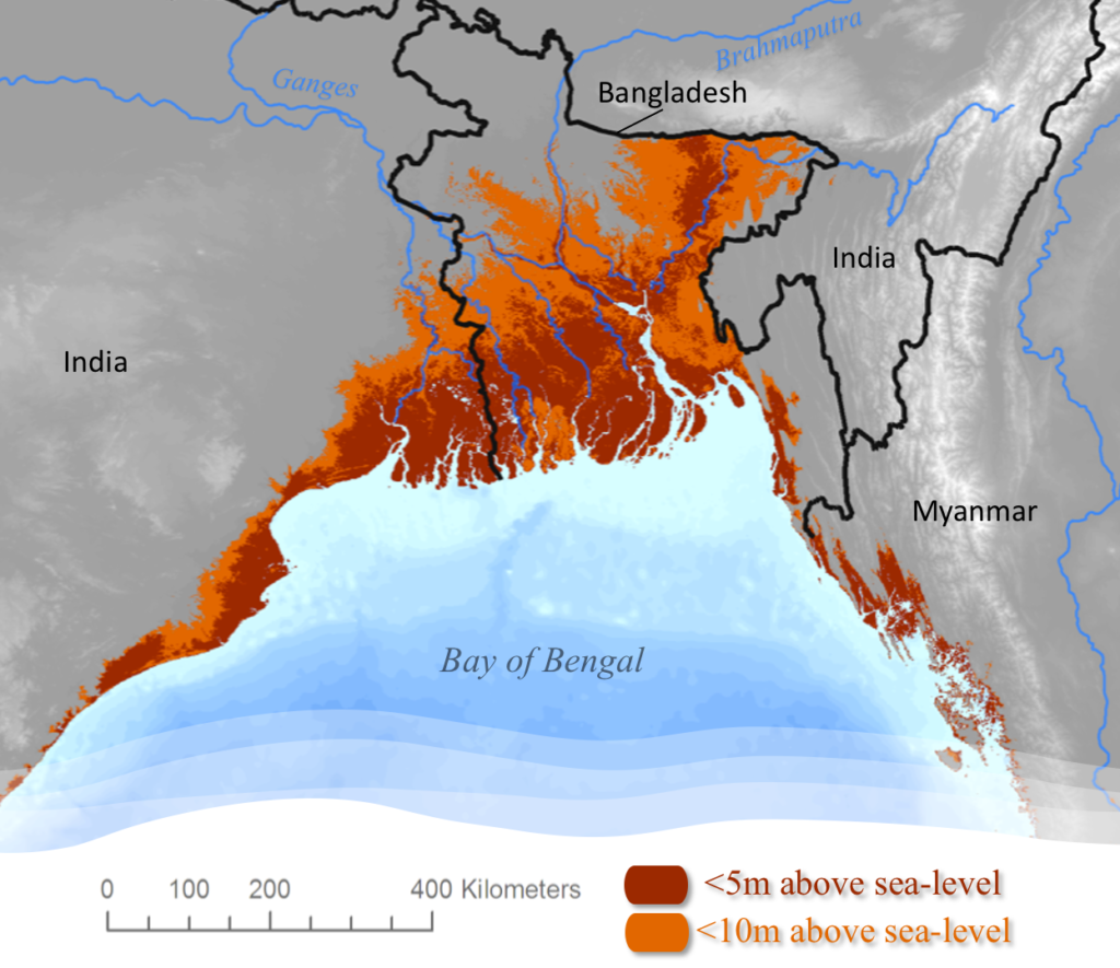
Located north of the Bay of Bengal, this delta of about 100,000 km2 is the largest and most densely populated delta in the world. This fertile plain of very low altitude is formed by the confluence of the Ganges, Brahmaputra and Meghna rivers. This region, which covers two thirds of Bangladesh and part of eastern India, is already regularly prone to flooding, favoured by the intensity of monsoon rainfall, river flows, cyclones, tidal ranges and rising sea levels.
On a global scale, it is in this delta that cyclones have been the most devastating. The cyclones of 1876, 1897 and Gorky in 1991 each caused at least 140,000 deaths, while Bhola in 1970 caused about 300,000 deaths. The impact of global warming on flooding in this region is currently causing great concern: will it become more intense and more frequent in the future?
The Irrawaddy delta
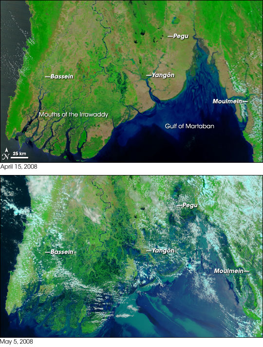
The Irrawaddy (Ayeyarwady) is the main river in Myanmar (Burma). Crossing the country from north to south, it originates in the Himalayan foothills and ends its course as a delta flowing into the Bay of Bengal. The Irrawaddy Delta is one of the most densely populated regions of Myanmar; about 15 million people (~30% of the total population) currently reside on its 35,000 km2.
In 2008, Cyclone Nargis struck Myanmar (figure below) causing more than 140,000 deaths and disappearances, some 2.4 million people were made homeless and more than $4 billion in damage. Although the coastal region of the delta appears to be more or less in equilibrium, with sediment deposition currently balancing subsidence and sea level rise, this situation is rapidly changing as a result of large-scale dam construction in the basin. Despite its importance in tropical deltaic systems, this region remains very little studied today. The DELTA project will contribute to filling this knowledge gap.

